Earth Textures
Every frame at PlanetAspera is powered by a custom-built, 8,031,551,047,200-pixel true-color texture of Earth — declouded, retouched, and crafted specifically for cinematic use. Matching ultra-high-resolution layers for elevation, night lights, water masks, and more bring each shot fully to life.
Most detailed texture of Earth ever.
When I first started visualizing places on Earth, I used the 84K NASA Blue Marble texture. It was an impressive dataset for its time — but the moment I tried to explore a specific region, mountain range, or city, it fell apart. There simply wasn’t enough detail to reveal the character of the landscape.
So I began building my own texture. Using data from the European Space Agency’s Sentinel-2 mission, I set out to create a version of Earth that could hold up to cinematic scrutiny — a texture detailed enough for film, yet accurate enough for science. What began as an experiment turned into an obsession. I wanted to push the boundaries of what’s possible with public satellite data. In the end, I didn’t just push them — I erased them.
The result is the Planet Aspera 8-trillion-pixel Earth texture: over 2,100 times more detailed than NASA’s 84K Blue Marble, and the most complete true-color representation of our planet ever created from open data.
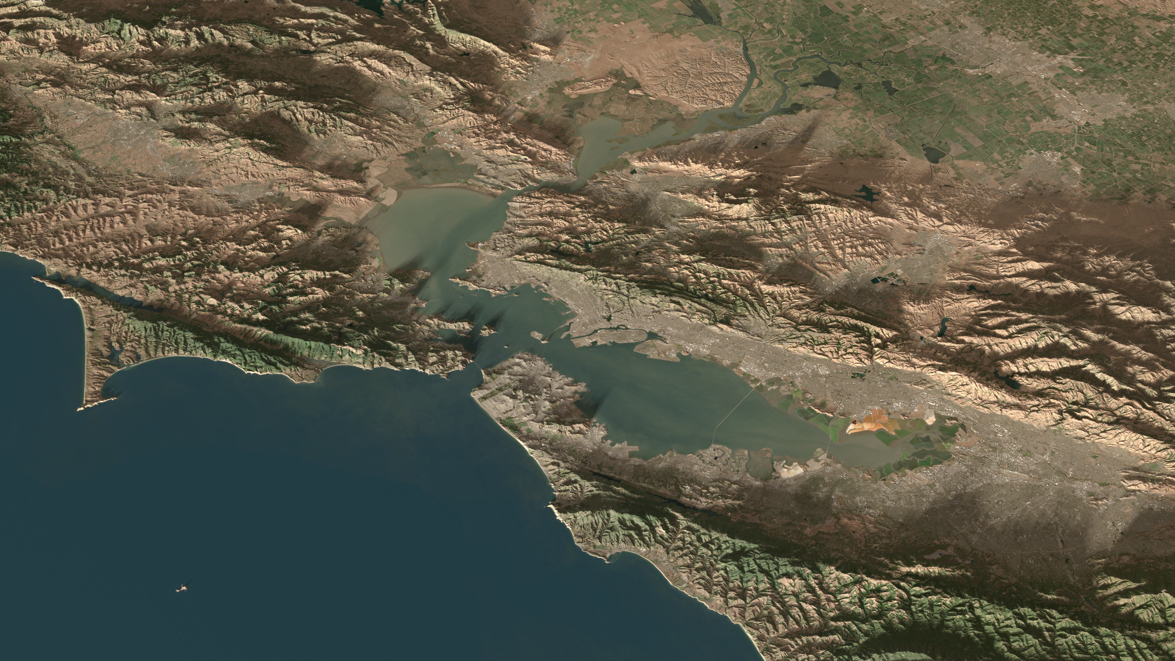
San Francisco Bay, USA
Blended into perfection… the whole Earth
Every pixel in this texture represents ten meters on the ground. The entire globe has been declouded, color-balanced, and manually retouched, one region at a time. Artifacts, seams, and lighting inconsistencies that appear in every global dataset — even those from Google Earth or NASA — were corrected by hand. Thousands of individual satellite scenes were blended together until coastlines, mountain shadows, and desert dunes merged seamlessly into one continuous surface.
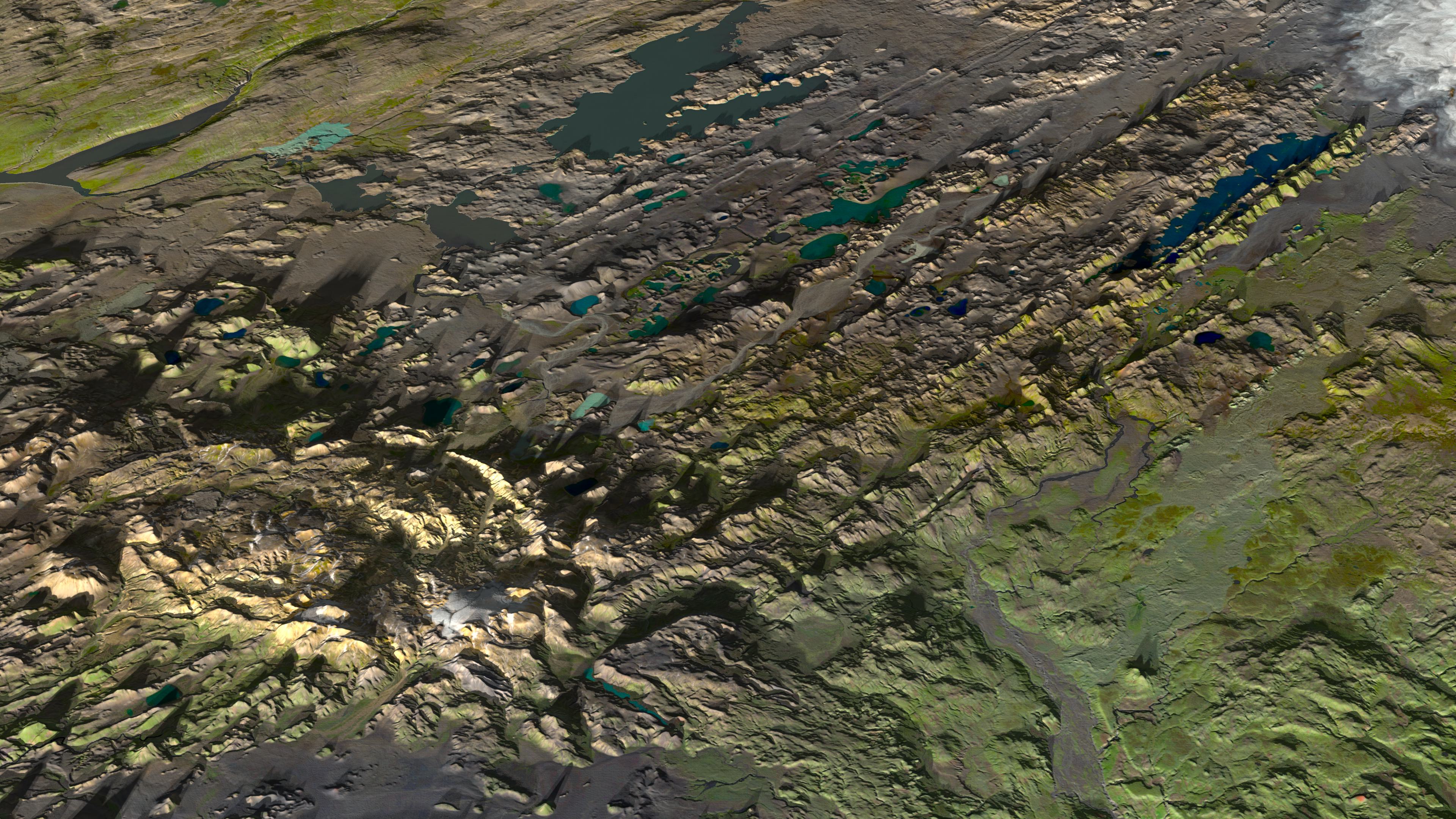
Landmannalaugar, Iceland
And this is only one layer. Matching ultra-high-resolution maps for elevation, night lights, and water masks bring additional depth and realism. Each has its own challenges, quirks, and corrections — all balanced to work together as a complete, coherent system.
The result is not a scientific composite, nor a simple map. It is a handcrafted digital Earth — a visual foundation for films, education, and research, where every frame reveals the planet as it truly is: cloudless, continuous, and breathtakingly detailed.
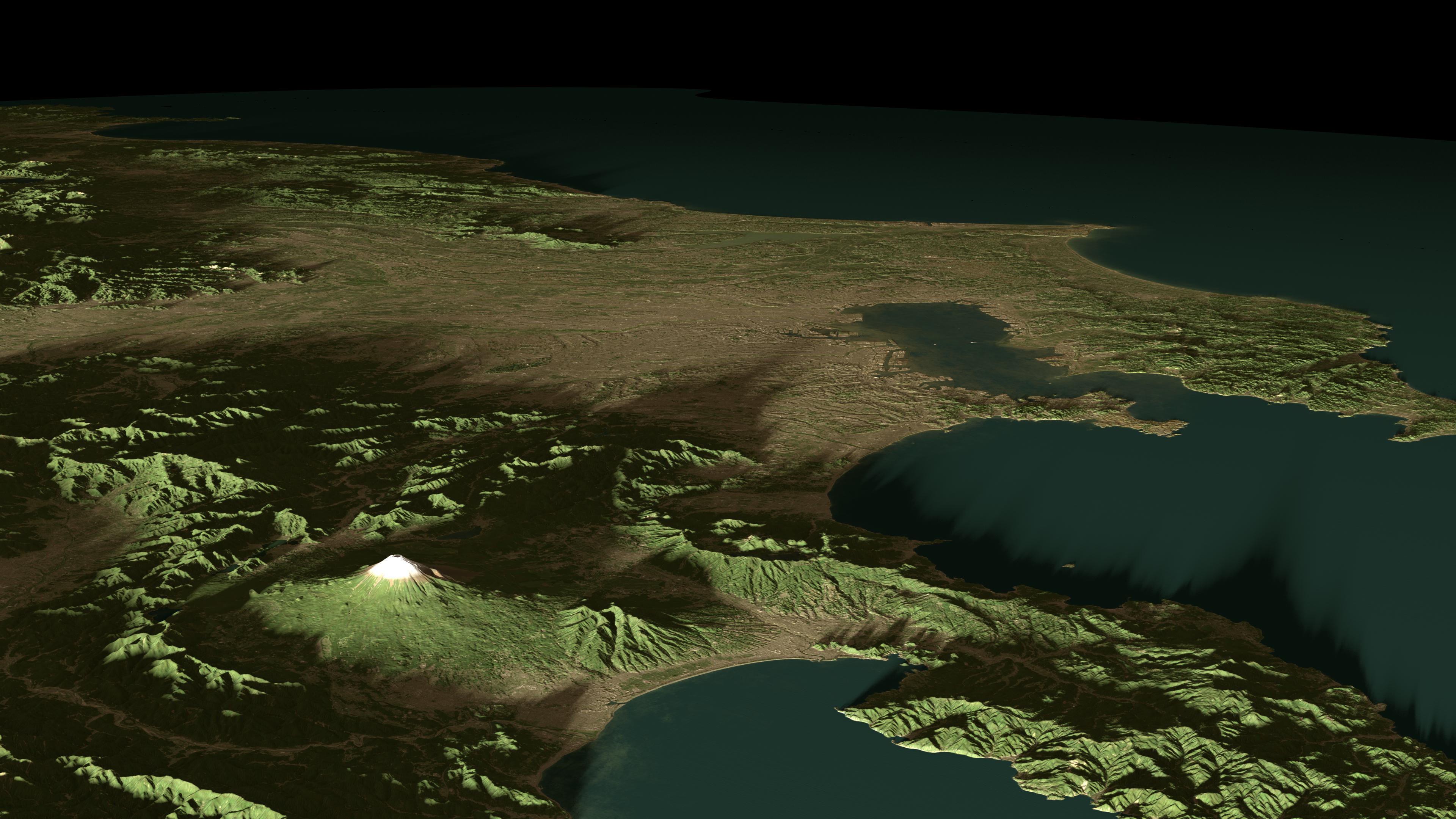
Tokio, Japan
Interested?
Interested in licensing the Planet Aspera texture for your own project or research? Please get in touch to discuss your use case and available formats. Each license is tailored individually, ensuring the data serves your vision with the same precision it was built with.
Most detailed texture of Earth ever.
When I first started visualizing places on Earth, I used the 84K NASA Blue Marble texture. It was an impressive dataset for its time — but the moment I tried to explore a specific region, mountain range, or city, it fell apart. There simply wasn’t enough detail to reveal the character of the landscape.
So I began building my own texture. Using data from the European Space Agency’s Sentinel-2 mission, I set out to create a version of Earth that could hold up to cinematic scrutiny — a texture detailed enough for film, yet accurate enough for science. What began as an experiment turned into an obsession. I wanted to push the boundaries of what’s possible with public satellite data. In the end, I didn’t just push them — I erased them.
The result is the Planet Aspera 8-trillion-pixel Earth texture: over 2,100 times more detailed than NASA’s 84K Blue Marble, and the most complete true-color representation of our planet ever created from open data.
San Francisco Bay, USA
Blended into perfection… the whole Earth
Every pixel in this texture represents ten meters on the ground. The entire globe has been declouded, color-balanced, and manually retouched, one region at a time. Artifacts, seams, and lighting inconsistencies that appear in every global dataset — even those from Google Earth or NASA — were corrected by hand. Thousands of individual satellite scenes were blended together until coastlines, mountain shadows, and desert dunes merged seamlessly into one continuous surface.
Landmannalaugar, Iceland
And this is only one layer. Matching ultra-high-resolution maps for elevation, night lights, and water masks bring additional depth and realism. Each has its own challenges, quirks, and corrections — all balanced to work together as a complete, coherent system.
The result is not a scientific composite, nor a simple map. It is a handcrafted digital Earth — a visual foundation for films, education, and research, where every frame reveals the planet as it truly is: cloudless, continuous, and breathtakingly detailed.
Tokio, Japan
Interested?
Interested in licensing the Planet Aspera texture for your own project or research? Please get in touch to discuss your use case and available formats. Each license is tailored individually, ensuring the data serves your vision with the same precision it was built with.
The Earth. Built for cinema.
The Earth. Built for cinema.
The Earth. Built for cinema.